North American Land Surveyors Canoe Team Logo

North American Land Surveyors  Canoe Team Logo
Logo Designed by Denny DeMeyer.

Wednesday, June 29, 2011

Short update

As I write this, we are now well underway on our epic journey toward Astoria, Oregon. The weather has been a mixed bag of snakes with some sun, some rain storms, wind, and some clouds. While it sounds bad, it has been a lot of fun! Internet connections are few and far between so the Blog hasn’t been updated on a very regular basis. Hopefully this will change as we get further south and west.

The original crew signed on for the six weeks included Robert Allen. Sharon Colht, Denny DeMeyer, Ian Emmerson, Bill Erickson, Jim Halliday, Bernie Kilonsky, Nancy Kilonsky, Mark McGladrey, and Diane Gregory. Mark McGladrey and Diane Gregory decided to leave camp on 05 June and we were left scrambling for a few days. Mark did leave us with some great spreadsheets we could use for our finances. Other than that, we persevered and were very quickly back on track. Sue Duxbury and Steve Sleep left on 09 June and Bruce Clark and John Armstrong left on 10 June. Tony Bachman, Gordon Linnell, Stan Mrzygod, Dwaine Ronnie, Bob Runnalls, and Bill Weikel joined us on 10 June while in Thompson Falls and they left on 17 June in Kettle Falls, as did Bill Chapman. We were then joined by Lynee Forsyth, Mary McDowell, Jerry Franklin, and Phil Abenroth.

We had some rough water, fast water, and slow water to paddle through and sometimes it was exciting and challenging! We had a terrific response from all the communities we went through. Various meals and other social functions were put on for us. Since starting, the weather has slowly improved and we had some sun and mid to high 80 F weather.

There isn’t much spare time as we are up at 5 or 6 each morning and usually on the water by 7 or 8 and paddle until mid afternoon. Before leaving camp each day, we have to take down our tents, pack them up, make our lunches, have breakfast and then get all the team gear packed up, and be on the water. When we arrive in our new camp, we have to set everything up again, try to clean up, have supper, have the captains attend the captains’ meeting, have our team meeting, and then it’s time to hit the sack again.

Spare time is limited as is evident by this missive. It has taken twenty days to write it.

Monday, June 27, 2011

23 June 2011


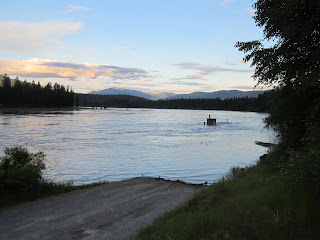
The view from the cabin on the river.

23 June 2011


Delores in the number two seat on a practice paddle. I think we have a new conversion.

22 June 2011


The outflow at Grand Coulee Dam.

22 June 2011


Some of the scenery along Lake Roosevelt.

21 June 2011


Denny in the sitting position explaining some of the finer points about David Thompson to some interested folks.

21 June 2011


Lynee giving Dwaine Ronnie a back massage.

21 June 2011


Our sponsors’ banner

21 June 2011


Mary McDowell at her tent at the Keller Ferry camp ground.

21 June 2011


Looking down at the Keller Ferry area on Lake Roosevelt.

20 June 2011


Lynee Bluff, named after our chief ‘switch’ counter, Lynee Forsyth. She counted to 50 (paddle strokes) before calling for us to switch sides and she did it for nearly eight hours. I don’t have my calculator to figure how high she might have counted. It is located at: 47* 57.502’ and 118* 20.841.

20 June 2011


A very hot day, on the way to Two Rivers

20 June 2011

A very hot day, on the way to Two Rivers

19 June 2011


Three of the four Canoe cleaning crew – Denny DeMeyer, Ian Emmerson, Jim Halliday. Robert Allen, the fourth member, took the photo.

19 June 2011


Arriving on shore at Inchelium.

19 June 2011


Figure eights at Inchelium.

19 June 2011


Gifford Ferry crossing Lake Roosevelt.

19 June 2011


Arriving at Inchelium

19 June 2011


The first canoes heading south on the Columbia River from Kettle Falls.

Saturday, June 18, 2011

Near Ione, WA.


Approaching the bridge over the Pend Oreille River near Ione, WA.

June 16th


Crew change on the Pend Oreille River near the old Ruby Ferry landing.

June 15th


Members of the Kallispell Indian Band at Cusick performing on the drum.

Author, Jack Nisbet, giving a talk on David Thompson on the banks of the Pend Oreille River.

Wednesday, June 15, 2011

June 14th

Internet access is rather limited and so is time. I will try to do a fuller blog in a few days. Thanks for your patience.

Robert

Preparing to Land


Koo Koo Sint preparing to land in Oldtown/Newport.

June 14th


Preparing to enter the Pend Oreille River just below the Albeni Falls Dam in Oldtown/Newport. Oldtown is in Idaho and Newport is in Washington, basically on both sides of the Pend Oreille River.

June 13th - VERY WET!!!!

Another very wet day! We bunked into a motel in Sandpoint to try to dry out. It was too wet to even take a photograph.

Clark Fork Campground


Our campsite in Memorial Field at Clark Fork.

Clark Fork Parade


The parade through the community of Clark Fork, on our way to our campground. Both the folks from Clark Fork and Thompson Falls went well out of their way to make us feel welcome. Thank you to both of them. Small town hospitality is wonderful.

Clark Fork - June 12


The welcoming committee at the community of Clark Fork, MT.

Clark Fork Bridges


Approaching Clark Fork.

Happy Geocaching Crew - June 12


The geocaching crew near the crew change on the Clark Fork River

June 11th


Part of our camp at Noxon, MT.

June 11th


At the put-in a few kilometres west of Thompson Falls. Note the outhouse half in the water. It is well flushed now.

Koo Koo Sint Ridge and Thompson River


The Clark Fork River is on the right; the Thompson River runs down the valley in the centre and Koo Koo Sint Ridge is to the right of the Thompson River. Koo Koo Sint was the name given to David Thompson by the Salish people of the area. It means the man who looks at the stars.

Team photo in Thompson Falls.


A Team photo in Thompson Falls before some of the original members left for home.

Clark Fork River


An early morning view up the Clark Fork River at Thompson Falls.

Thompson Falls - June 9th


After arriving in Thompson Falls, MT, we held a parade downtown from where we took the canoes out of the water to our campground, about one kilometre. The local folks were terrific.

Kootenai Falls


Kootenai Falls in full water.

Wednesday, June 8, 2011

Arriving in Libby, MT


It rained all night and then most of the day. It was dry in the tents but only barely as it rained so hard all night! The canoes made it into Libby into a very hard landing location.

The Plaque


The Plaque itself.

Unveiling the Plaque


The plaque to commemorate David Thompson and his travels is unveiled by the International Boundary Commissioners.

At the Border


The Brigade has arrived at the Border and now is the time to be cleared for entry into the USA.

Approaching the Border


The Brigade is approaching the USA/Canada border.

Surveyors Lake


There is one lake in Kikomun Creek Provincial Park called Surveyors Lake. What's a Surveyor to do but walk around it?

Leaving Kikomun Creek Provincial Park


07 June - leaving towards the border.

Paddling Down the Kootenay


06 June 2011 - The Steeples in the background.

SoBs at McElhanney BBQ


The Surveyors on Bikes at the steak BBQ at Fort Steele sponsored by McElhanney Surveys (Cranbrook) and John and Carol Armstrong.

Veterans of the 2008 Brigade


Gord and Floss Thomson, our good friends and honourary Team members, accompanied by an RCMP constable at the celebration at Bummers Flats.

Down the Kootenay River


Leaving from near Wasa on 05 June. The warmest day yet.

Preparing to Arrive in Invermere


Putting on the regalia prior to our arrival in Invermere - 03 June

Crew Change


Our first crew change and lunch break on the Columbia River in Fairmont Hot Springs.